
Google regularly adds innovative features to Google Maps to provide an excellent experience for users. If you are an avid user of Google Maps, you can always find new things hidden somewhere. Most of us might have tried out the Street View option in Google Maps to explore an area in-depth. The same Street View feature can also be used to view the history of your apartment or any place.
How to View Old Street View Images of a Place on Google Maps (Web)
Are you curious about what your neighborhood looked like a few years ago? Well, Google Maps stores the image of a location dating back to even 2007. So, you can easily glimpse how your apartment looked a decade ago or more than that. Let’s see how to do that.
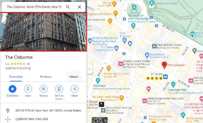
- On any browser, go to maps.google.com.
- Start typing the address of the place and click the correct one from the list of options.
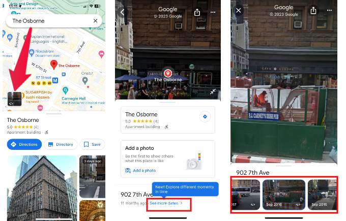
- On the left side of the screen, click anywhere on the preview image of the location. (If there is no preview, it means the photo of the location is not added to Google, and you cannot view the history of that)
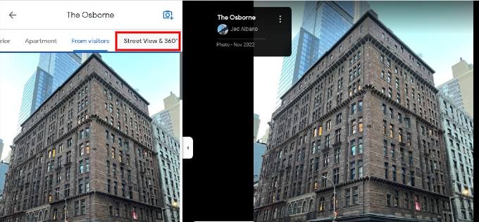
- Click Street View & 360.
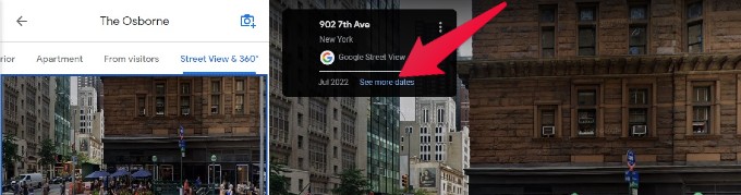
- On the right side of the screen, click See more dates shown on the small black box.
- By clicking the thumbnail, you can view the full street view image of the location. You can click the left/right arrow to move through the list of photos.
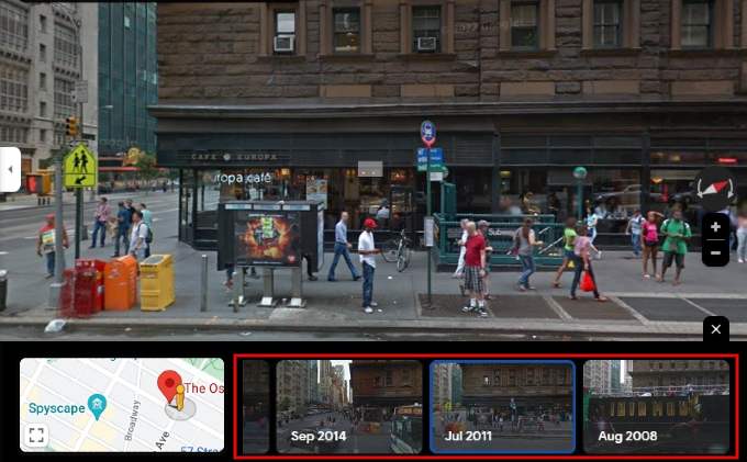
- You can see the thumbnails of past photos of the location at the bottom of the screen.
10 Best GPS Trackers to Keep An Eye on Your Cars Rented Vehicles.
How to View Old Street View Images of a Place on Google Maps (Mobile)
You can view the history of a place on the go using the Google Maps app on your iPhone or Android. The steps are very similar to that on a computer. Let’s see how to do that. In this example, we are using an iPhone.
- Launch Google Maps on your device and type the address of the place for which you want to view the history.
- Tap the thumbnail with the Street View icon that appears on the map.
- Scroll down to the bottom of the screen and tap See more dates.
- Tap the thumbnail of any past photos to view the full image.
If their photos are added to Google, we hope this hidden feature will help you see the old street view images of your apartment, restaurant, shopping mall, or any place.
Google Maps has revolutionized how we explore the world, allowing us to journey back in time. With the ability to view old images of our homes, favorite places, and cherished memories, Google Maps offers a unique and nostalgic experience. Whether you’re curious about how a location has evolved or want to reminisce, this feature provides a captivating window into the past. Embrace the wonders of modern technology and take a trip down memory lane with Google Maps.