
Smartphones have revolutionized the way we travel. A lot of the tools and equipment you once needed are now built into your smartphones. Maps, compass, weather information, rides, hotels, you can take care of almost everything on your smartphone. If you love hiking or trekking you can also find altitude on Android. Wherever you are in, it is now easier to find your current altitude or elevation using your smartphone.
Here, we will show you how you can find your current altitude and elevation from sea level of any location using your Android smartphone.
Content
- Find Altitude on Android with Google Maps
- Find Current Altitude on Android with Altimeter GPS
- More Altimeter Apps on Android
- Altimeter on Android: FAQs
Find Altitude on Android with Google Maps
Before we dive into the world of apps we should probably talk about Google Maps. It ships pre-installed with nearly all Android smartphones. Unless your needs are very specific, Google Maps can also help you find the elevation at certain places.
It isn’t the most ideal solution but if you can read maps it works and you don’t need to install an additional app. Google Maps can show you the altitude of locations, especially mountain terrains.
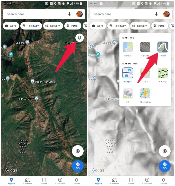
- Launch the Google Maps app on your phone.
- Tap on the Layers icon on the right under the search bar.
- Select Terrain from the expanded menu and tap anywhere on the map to close the menu.
- Zoom in on any natural mountains or plateaus on the map slowly.
- Once you’re at the right zoom level, you will see contour lines.
- Zoom in a little more and you should also see numbers denoting the elevation.
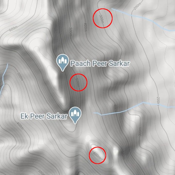
If you zoom too much you will lose the contour lines and the numbers so you have to play around a bit. The elevation numbers can be hard to read since they’re written on the contour lines.
Related: 10 Best Google Maps Navigation Tips you Must Know
Find Current Altitude on Android with Altimeter GPS
If you’re looking for more convenient measuring tools you’ll have to look at some of the third-party altimeter apps for Android on Play Store. There are a handful of apps available to measure your current altitude on Android. If you are an iPhone user, it is also possible to find your current elevation using iPhone as well.
If you’re someone who loves hiking, skiing, mountain biking, etc. Altimeter GPS is one of the best apps. The app provides easy measurements for altitude, elevation, or localization coordinates, mostly offline.
You can simply install and open the Altimeter GPS app to start measuring your current altitude in realtime.
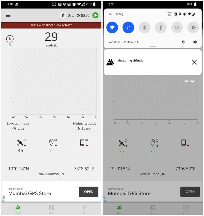
When you first launch the app and allow necessary permissions, it takes a little while to take measurements. Once it is done though you don’t have to do anything manually in order to measure altitude.
A notification from the app displays your current altitude, so you do not have to open the app every time.
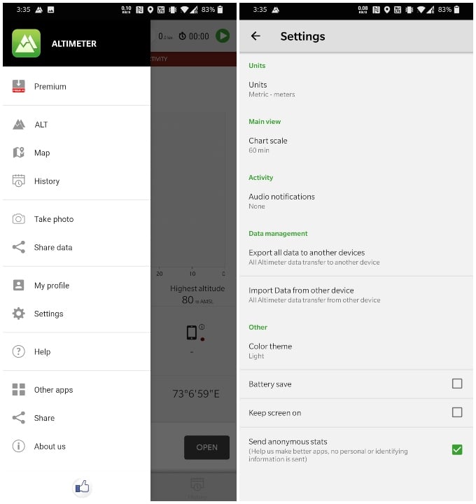
Apart from the current altitude measurement, you can also find a little compass in the top left corner of the app. At the very top on the left is a built-in timer to record your activities.
You can also see the lowest and highest altitude in your current area. There are some other features such as a history of your recorded activities as well as a Maps tab. The app gives you a few configuration options in Settings as well.
Download Altimeter GPS: Play Store
More Altimeter Apps on Android
Android has no shortage of apps for pretty much anything you can want from your phone. Naturally, there are plenty of other altimeter apps you can use to find altitude on Android.
My Elevation
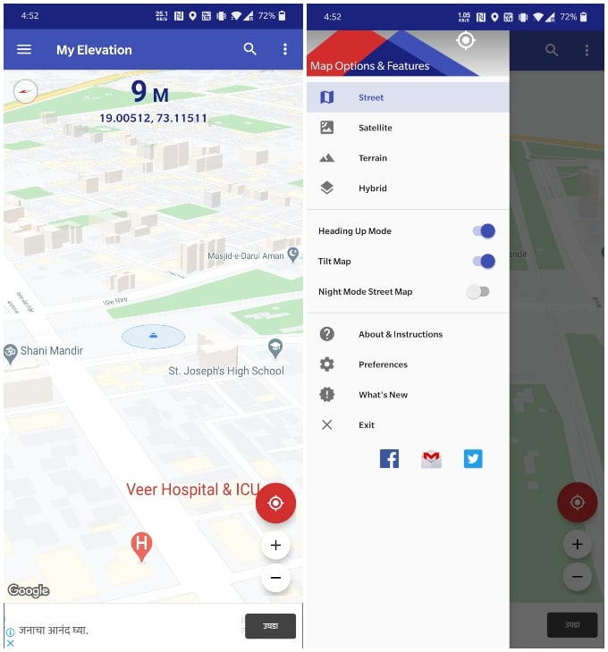
My Elevation gives you precise measurements but it will not work if you’re offline. Apart from the one big flaw, the app is pretty decent. It uses web services to get your current location. Altitude measurements are provided based on your latitude and longitude.
It features a Follow Me mode which tracks your movement and gives you accurate elevation data accordingly. Apart from altitude, you can also search for nearby attractions using this altimeter app. You can also bookmark places like you would on Google Maps.
Download My Elevation: Play Store
Altimeter Ler Live Gps Geotracker
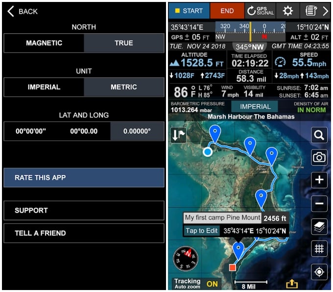
You can see screenshots above so let’s just address the fact that it is not the most visually appealing app. Altimeter Ler, however, is definitely the app with the most information, at least on this list. If you really care about hiking and biking in mountainous terrains then you will want this app.
So the app supports both Imperial and Metric systems. The app makes use of Google Maps and provides you with different layer options. There’s not only a built-in compass but also a camera.
It provides you with a ton of information such as Time elapsed, distance, average speed, maximum speed, Latitude & Longitude, etc. Yes, of course, it also shows information about your current altitude.
Download Altimeter Ler Live: Play Store
Altimeter Alarm: Altimeter, Track Hiking & Maps
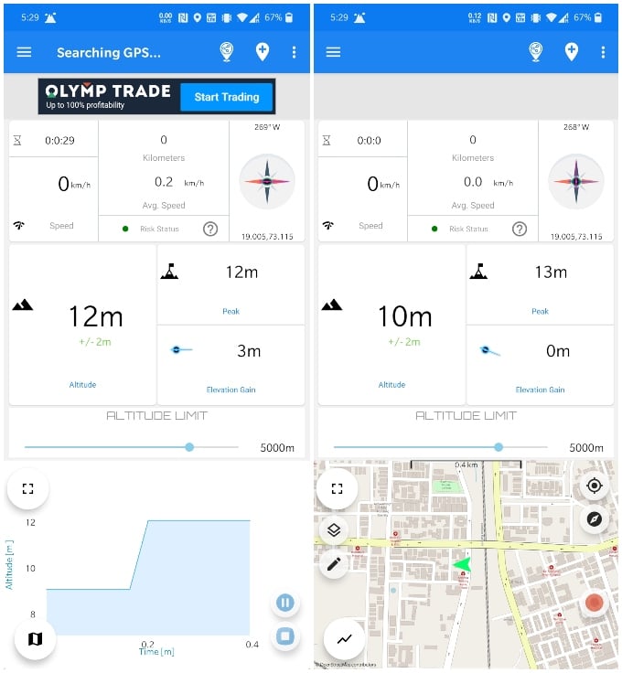
The app measures and shows your real-time altitude on the map and a graph. The app includes a slider for maximum altitude. If you cross this limit the app will let you know, and hence the name Altimeter Alarm. There’s also an Altitude sickness alarm, just in case.
There are also periodic voice notifications about the altitude you’re at. It also records peak points and barometric pressure. Altimeter Alarm includes a social aspect and lets you share routes with other users.
Download Altimeter Alarm: Play Store
Altimeter on Android: FAQs
With several apps available on Play Store, your smartphone can easily tell your current altitude and elevation above sea level, with the help of internet or not.
While these apps are great, your phone was never designed to measure altitudes. This is why most phones don’t have a decent GNSS chipset and a barometer built-in. If your phone does, you’re in luck. But if it doesn’t, you might get spottier readings using location satellites alone.
In that case, you’re better off getting an actual Altimeter. It also depends on how often do you need an Altimeter and if you really need that kind of accuracy. For most people, one of the Altimeter apps mentioned above should be enough.
Most of the altitude measurement apps are used in mountain regions. Due to the internet unavailability in such places, there will be a lesser accuracy in altimeter apps on Android. But, they are nearly accurate when you have an active internet connection.
Apart from the above-mentioned apps, you can use plenty of other altimeter apps. They all can help you find your current altitude using your smartphone. In case you need accurate data always, we always recommend you get an Altimeter device.
Great tip! I had no idea it was this easy to find my current altitude on Android. Thanks for sharing this, I’ll definitely be using it on my next hike!
Great tips! I never knew my Android could easily show altitude. The step-by-step guide was really helpful, especially for outdoor activities. Thanks for sharing!
This is a really helpful guide! I never realized how easy it could be to find my altitude using just my Android phone. The app recommendations were especially useful. Thanks for sharing!