
Whether you are commuting daily to your office or visiting new places on weekends, you always need a navigation app on your car. If you are an iPhone user, you might stick to Apple Maps. However, you can also use Google Maps and Waze as they provide some extra features. But which one is good for you?
In this article, let’s see a detailed comparison between Google Maps, Waze, and Apple Maps, and you decide the best one for you.
Google Maps vs. Waze vs. Apple Maps
Google Maps: It is undoubtedly the most popular navigation app as it has more than one billion monthly users. Since its launch in 2005, Google has been constantly adding new features and improvisations to provide a better user experience. For example, you can download Google Maps for a particular area and use the map offline without an internet connection. Other notable features include real-time turn-by-turn voice assistance for navigation, adding stops in a route, sharing trip progress or live location with others, adding reminders, and much more.
Waze Map: Waze is a good option for those users who drive only cars and don’t rely on ride-sharing or public transportation. The main goal of Waze is to help drivers reach their destination as quickly as possible by providing them with the fastest route.
When compared with other navigation apps, Waze provides quick navigation routes as it regularly receives updates from other Waze users on traffic jams, toll rates, road hazards, accidents, and even cops. Like Google Maps, Waze is also compatible with both iOS and Android devices, CarPlay, and Android Auto.
Apple Map: When Apple introduced Apple Maps in 2012, it had a lot of issues and got heavy criticism from users as it was unable to locate even the basic addresses. However, Apple has sorted out those issues and these days Apple Maps can be considered a good competitor for Google Maps.
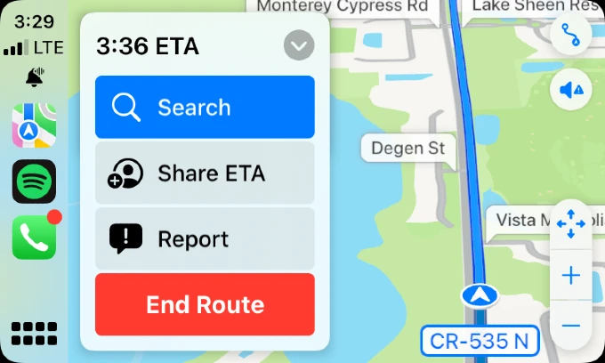
From sharing your ETA with someone to exploring your city in 3D view, Apple has been adding improvisations to Apple Maps on every iOS release. With Apple Maps, you can add your favorite locations, view parking/toll information, get weather warnings on routes, report incidents on roads, book cabs, and much more.
| Feature | Google Maps | Apple Maps | Waze |
|---|---|---|---|
| Accuracy | Best | Good | Good |
| Speed | Yes | Yes | Yes |
| Compatability | Can be used on Android, iOS, Windows, CarPlay and Android Auto. | Can be used only on Apple devices like iPhone, iPad, Mac, and Apple Watch. | Can be used on both iOS and Android devices. |
| Hazard Reporting | Yes | Yes | Yes |
| Police Alerts | No | Yes | |
| Speed Camera Alerts | You can receive notifications on the screen. | You can view the speed camera on maps. However, there is no option to receive alerts at the time of writing. | If your driving speed exceeds the limit, you will receive both a voice alert and a notification on the screen. |
| Red Light Camera Alerts | Yes | Yes. Select countries | Yes |
| Business Listings | Yes | Yes | Yes. Limited |
Navigation Accuracy
For any navigation app, accuracy is a critical factor as it helps to reach any destination quickly without any delay. Both Apple Maps and Google Maps calculate and provide time estimations based on the current traffic conditions.
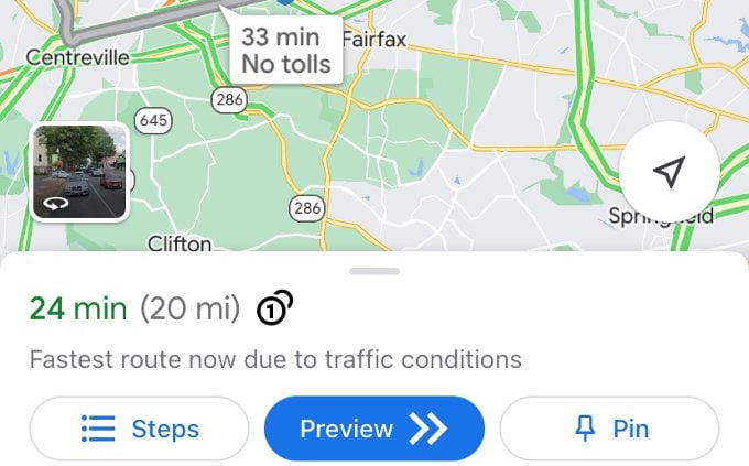
Unlike Google Maps, Apple Maps show alternate routes for the same destination so that users can select the route they wish. For example, some users will always prefer the fastest route while others might expect only fewer turns.
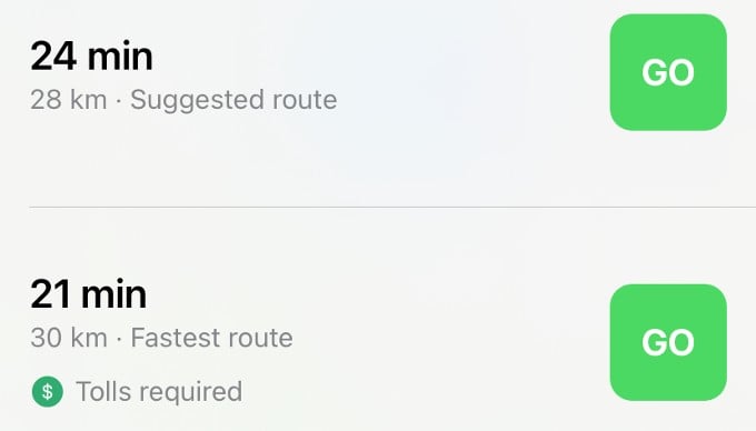
Though Waze and Google Maps are both owned by Google, they work in a different manner. Both Waze and Google Maps provide accurate routes by considering the traffic condition, weather, and other factors, Waze is always focused on ETA (Estimated Time of Arrival). If the ETA gets changed, Waze will reroute the navigation and ensures there is no time delay whereas Google Maps is focused on the overall efficient route.
Winner: Google Map
Car and Watch Compatibility
Generally, any service provided by Apple will work only for its devices, and Apple Maps is not an exception. You cannot use Apple Maps on an Android device or Windows computer. But, you can seamlessly use Apple Maps on your Apple Watch. Once your Apple Watch is paired with your iPhone, any directions displayed on your phone will be automatically sent to Apple Watch.
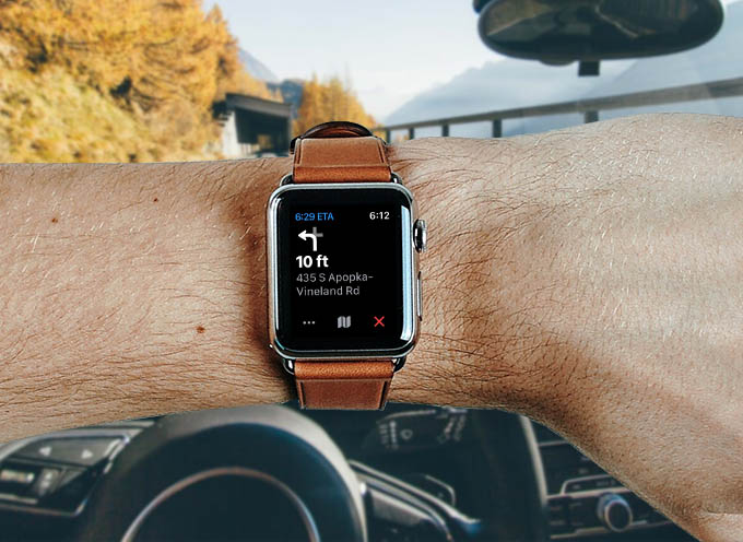
By making use of haptic alerts (a tap on your wrist) you can keep your iPhone away and use the Apple Watch to receive turn-by-turn directions to your destination. You can also use your Apple Watch to view your saved locations or to look for a new location as well.
Google Maps, on the other hand, is also compatible with most Apple products starting from iPhone to Apple CarPlay (including Apple Watch). The Watch app for Google Maps also has similar turn-by-turn navigation with haptic feedback. On CarPlay, you can get the most out of the Google Maps from your car’s head unit/stereo if compatible.
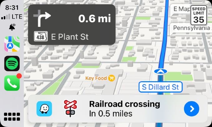
If you are trying to get haptic feedback on your Apple Watch, Waze is not an option since it can work only with iPhones and CarPlay stereos. You can get excellent navigation with timely alerts on your car if the stereo supports either Apple CarPlay or Android Auto.
Winner: Apple Map
Hazard Reporting and Alerts
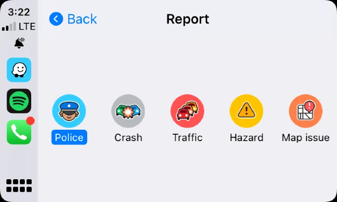
Since Waze is community-based, it was the first one to display real-time traffic conditions like lane closures, road hazards, accidents, etc. This will help the drivers to take alternate measures. The app also lets you report and verify any roadblocks or accidents.
Google Maps and Apple Maps also show traffic hazards like lane closures, crashes, and construction work but sometimes you will get only little to no alerts since not many people care to report on Google Maps and Apple Maps.
Recently, Google Maps also added a new feature that allows users to report live traffic incidents like crashes and road hazards.
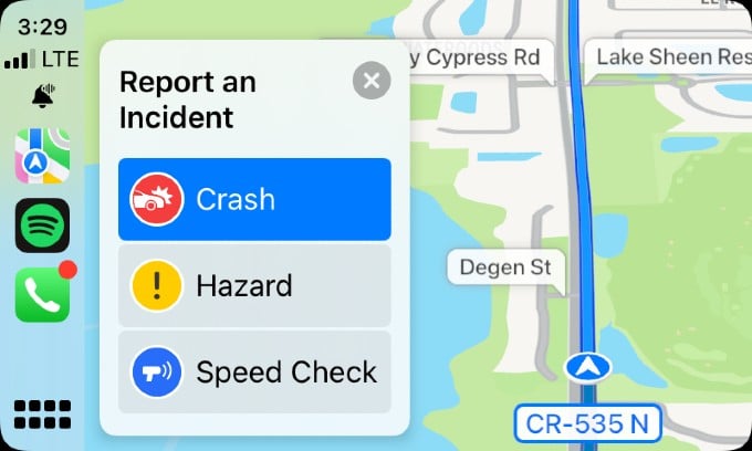
If you are using Apple Maps, you can easily get the help of Siri to report traffic incidents. For example, you can trigger Siri and say something like “There’s a speed check here”. After getting reports from users, Apple evaluates them and displays the relevant incident markers on the map.
Winner: Waze Map
Live Traffic Status
Navigation apps can provide only an approximate ETA which might change due to the level of traffic on roads. To help you to get the heads-up, Google Maps provides the Live Traffic Status. Just by looking at the color codes on the map, you can easily find out the traffic status.
For example, if you see green color, then you need not worry about the traffic as it is clear. If you see red color, then you should expect some delays due to heavy traffic.
You can also view the live traffic conditions on Apple Maps with Orange indicating slowdown and Red indicating stop and go traffic.
- Green: Free Flow
- Yellow: Light Traffic
- Light red: Moderate Traffic
- Red: Heavy Traffic
- Dark red: Traffic is near a standstill
Waze also provides a snapshot of the live traffic with 5 color codes as shown above, that can clearly identify wheel you chose your next trip.
Winner: Waze Map
Speed Camera and Red Light Camera Alerts
Though no one would like to spend their valuable money on speeding tickets, sometimes it happens. The best way to avoid speeding tickets is to always drive within the maximum speed limit. However, if there is no traffic on the roads or other drivers are going 5-10 mph faster than the limit, you might get the urge to follow them. To overcome that, you can make use of the speed camera alerts which are available on Google Maps, Waze, and Apple Maps.
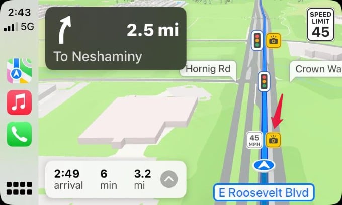
Apple introduced speed camera alerts in iOS 14 and since then it has been rolling out that feature to more countries. While you are navigating using Apple Maps, you will see a Yellow camera icon to indicate the speed camera.
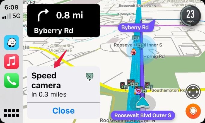
In Waze, you will get an alert before you enter a speed camera zone so that you can reduce the speed to avoid a speeding ticket.
Winner: Waze
Use with Trails for Hiking
This depends on the location and the map. If you are in California or San Francisco, you get most of the trail details with Google and Apple Map. Again it depends. You don’t know which map app is going to give you the trail information until you check with that location.
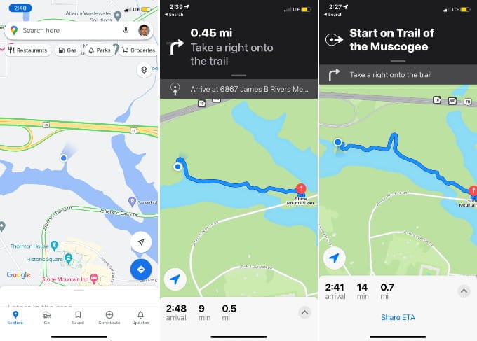
When I went for an hike in Stone Mountain, GA, the Apple Map support the trial information, while Google was blind at the scene. Google Map was not showing any useful details over there and finally I depend on the Apple Map.
Winner: Apple Map & Google Map
Can I Use Two Maps Apps at a Time?
You might not want to stick to a single Map app since you will miss some important features from the other. While Google Maps is good for long trips and adding stops en route, you will need Waze to not get caught by speed cameras and red light cameras. If your question is whether you can use two such map apps at a time on your iPhone, yes you can.
You can put the same destination in two or more navigation maps on your phone. You can, however, view the navigation in only one app at a time. Of course, you can switch to the other opened apps at any point in time. Let’s say you are using Google Maps for navigation and you got stuck on the road due to poor traffic. To reach your destination quickly, you can open Waze and start navigating to the same destination.
Even the CarPlay or Android Auto supports to work dual map at the same time. And you can get the pop-up of the map while you running with a diffrent map on the active screen. For example wheel you are using the Apple Map on the screen, Waze can pop-up and alert you for the road hazard or speed cameras. You can enjoy the missing features of one map app, by running your favorite app on the active screen.
Which Maps App Should You Use?
Each navigation app has its pros and cons. Instead of relying on a single app, it is worth installing multiple map apps on your phone and trying them based on your need. For instance, you can Waze to drive to your office every day as you will be more focused on saving your time. And, if you are planning a vacation or a long drive on road, you can use Google Maps as you can quickly find restaurants, gas stations, and more.
Since Apple Maps allows you to save multiple addresses as favorites, you can use that to quickly navigate to the frequently visited places.